I'm doing this to give you an idea, and a look at how much beauty and history there is to be seen 'close to home'. As you can tell, I live in the
Central Valley which puts me approximately 100 miles from San Francisco and Yosemite National Park! I'm only going to name a few locations, or we would be here all day. But you get the idea, right? I'm going to start off with where I live, (I wasn't going to),but in all fairness maybe I should.
Location: Waterford, Ca.
View Larger MapHistory: Located in the heart of the Central Valley, Waterford is the 8th largest city in Stanislaus County with a population which has grown steadily from 2,683 in 1980 to over 7,800 today.
Known as the "Gateway to Recreation", the city plays host to the thousands of people who travel through on their way to the many recreational opportunities in the area.
Originally settled in 1857 by William W. Baker, the town was originally named Bakersville. Mr. Baker homesteaded 160 acres just south of the river near the Appling Road Bridge.
In 1870 the post office was apparently having trouble delivering the mail as the name was being confused with the other places ( at the time the only other similarity was Bakersfield) so the post office suggested the name be changed. So in 1870 the name was changed to Waterford.
The surrounding areas are filled with farms and agriculture.


 Location
: La Grange, Ca. (
about a 20min. ride)

 History: The town of La Grange, in Stanislaus County, is situated on the beautiful Tuolumne River, thirty-five miles, southwest of the gold mining towns of Columbia and Sonora. Originally called French Bar, named after early French settlers, La Grange is one of the oldest towns in the county and dates back to the early days of 1849 when the excitement of the gold rush ran high. La Grange was used as the location for Bret Harte's stories. Three of his books, "M'liss", "The Tale of Three Truants", and "Four Guardians of La Grange" depicted episodes of Harte's teaching career in La Grange. The town also has several old cemeteries. French trappers founded the oldest Catholic Church in Stanislaus County, the St. Louis Mission, in 1852. The church sits atop a bluff overlooking a once booming gold town. The church cemetery dates back 130 years. The church still continues to serve the Cathoic community with mass every Saturday evening at 5:30 p.m. The La Grange Saloon was originally known as the Levaggi Bar and was built in 1897 by Louis Levaggi, Sr. Having been rebuilt after a fire, it has been in continuous operation. Today, the La Grange Saloon and Grill is owned and operated by Bob and Deborah Parsons. With it's large backyard and stage, the Saloon has the opportunity to provide entertainment and host large parties. They have a full bar inside and a menu packed with delicious food. They welcome everyone at the saloon, tourists, families, campers, and bikers; and their friendly, fun loving staff will do their best to ensure your visit is one that will have you coming back again and again.Location:
 Knights Ferry
(about a 35min, ride)
 History: Knights ferry:The original wooden bridge, constructed upstream from here in 1857, was destroyed by a flood in 1862. This covered bridge, built in 1863 was a privately operated toll bridge, until purchased by the county in 1884. It was closed to vehicles in 1981. The bridge has elevated interior footwalks with only a wagon's width of space between. The boards of the roadbed were protected with sand, later paved over with asphalt. Three piers of local stone, sharpened on the upstream side support the planking. Bridges were covered for permanence. Wood can survive a long time immersed in water, but alternate wetting and drying cracks and weakens it. To help strenghten the bridge, overhead cross-bracing was locked with inch-square locustwood pins, which are still in place.
Knights Ferry is also known for rafting trips that host up to 1000 people a day in the summer months.
 Location:
 Chinese Camp
(about a 45min. ride) History: This Southern Tuolumne County community is steeped in history. During the height of the Gold Rush, more than 5,000 Chinese lived here -- hence the name. Many settled to help build the railroads ... others to work in gold mines. Today Chinese Camp has less than 200 residents but there is ample evidence of its colorful past including old buildings and cemeteries. Chinese Camp is easy to find -- it's right on Highway 49 about 5 miles south of Jamestown. If you are accessing Yosemite via its 120 Big Oak Flat entrance, you'll go right by.
The Post Office Building was erected in 1854 and first housed Timothy McAdams’ general store, after which it served as the post office for many years. This cool building was made of stone with a brick front for looks and was one of the few post offices in the state which had outside boxes for public use. A plaque on the right side of the building honors Eddie Webb, one of the last stagecoach drivers to roll through town.

St. Xavier’s Catholic Church was the first non-Chinese house of worship in Chinese Camp. Built in 1855 by popular subscription of funds and labor, the structure originally had a shingle roof which was replaced with sheet iron and several coats of paint when the building was restored in 1949. Father Henry Aleric was the first priest to serve the seventy parishioners at Chinese Camp. He traveled a circuit through the mines, covering an area stretching from Knights Ferry to Second Garrote. He rode a mule. The church is located on a hill across the highway.
Location: Coulterville, Ca.
(about a 60min, ride) History:
 Coulterville was named after George W. Coulter, who in 1850 established some tent stores in the area with George Maxwell. The Mexican miners who were already working the area gave the town the name Banderita ("little flag") after a small American flag outside Coulter's tent. When the post office was established on Nov. 20, 1852, the town was given the name Maxwell's Creek, but in 1872, the name was changed to Coulterville.
By the 1860's, the placers were almost played out, but, unlike other gold rush towns, it didn't affect Coulterville as it was well established as a supply center. Eventually it was discovered that Coulterville sat upon one of the richest veins of gold-bearing quartz in the Mother Lode and soon hard rock mining became an important part of the town's activity (mining continued well into the 20th century).
Even though Coulterville was plagued by fire, as were many gold rush towns, burning to the ground in 1859, 1879, and 1899, many historic buildings have been preserved. Coulterville's Main Street appears in the National Register of Historic Places and the town itself is a State Historic Landmark (
#332). Coulterville is located at the intersection of CA-132 and CA-49
The first application of a park concept originated in Yosemite with the grant of 1864 (Federal land given to California for preservation) signed by Abraham Lincoln and since that time the park has played an important role in pioneering park management concepts.
While man has lived in Yosemite for thousands of years, the park's human history is far shorter than its geological history. At one time, this area was made up of gentle rolling hills, crisscrossed with a maze of stream systems. Millions of years ago, California's Sierra Nevada was formed by a gradual series of earth upheavals. As the mountains rose, the land tilted and the westward flowing Merced River accelerated, carving deep, v-shaped river canyons. Later, massive glaciers flowed down the canyons. Colder temperatures slowed melting and eventually glaciers formed and began to carve away at the v-shaped canyons, transforming them into u-shaped valleys. Tributary streams did not carve their canyons as deep as Merced Canyon. Glaciers sheared off these canyons leaving them as "hanging valleys." Tributary creeks, which had once joined the main stream at the same elevation, now plummeted off of shear cliffs, giving birth to the park's famed waterfalls. Eventually, sediment washed down out of the high country, filled in Lake Yosemite to form the present valley floor.


The area's first residents were Native Americans who inhabited the region perhaps as long ago as 7,000 to 10,000 years. Various tribes lived in the area over the years, the most recent of which was a Miwok tribe that called Yosemite Valley Ahwahnee which is believed to mean, "place of the gaping mouth." They referred to themselves as the Ahwahneechee.
In 1890, Robert Underwood Johnson, editor of Century Magazine, and John Muir, were concerned that the high country and watershed for Yosemite Valley were being destroyed by grazing and timber interests. The two launched a successful campaign to persuade Congress to set aside the high country as a national park.
In 1906, Yosemite Valley and the Mariposa Grove were returned to federal jurisdiction. In 1932, the Wawona Basin, including the Wawona Hotel and golf course were purchased and included in the National Park.
Open since 1927, The Ahwahnee is one of America's most distinctive hotels, unparalleled in magnificence and charm. The hotel is a great American castle, massive and warm with huge cathedral ceilings, enormous stone hearths and richly colored Native American and Oriental rugs. The hotel was designated a National Historic Landmark on 02 Jun 1987.


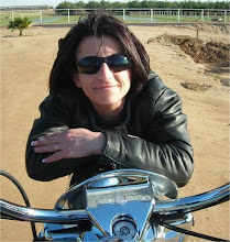
Yes, I have been to all of these locations, and
most of these pics are mine.
There is so much more to be seen in the surrounding area, and I will probably post them at some time or another. These locations are really within minutes from my home, and I would like to challenge you to learn more about your local rides, and the history behind them. I am looking forward to read or hear about your history!